My good friend Anne had found a new way to avoid the 401 Freeway to Toronto from Peterborough—through the country! I was hooked. The first leg took us along Hayes Line, up and down drumlins through wonderful forest, marsh and farmland. We passed a few charming hamlets (Bethany and Nestleton) along the way to our first destination for a late lunch in Port Perry, on Lake Scugog.
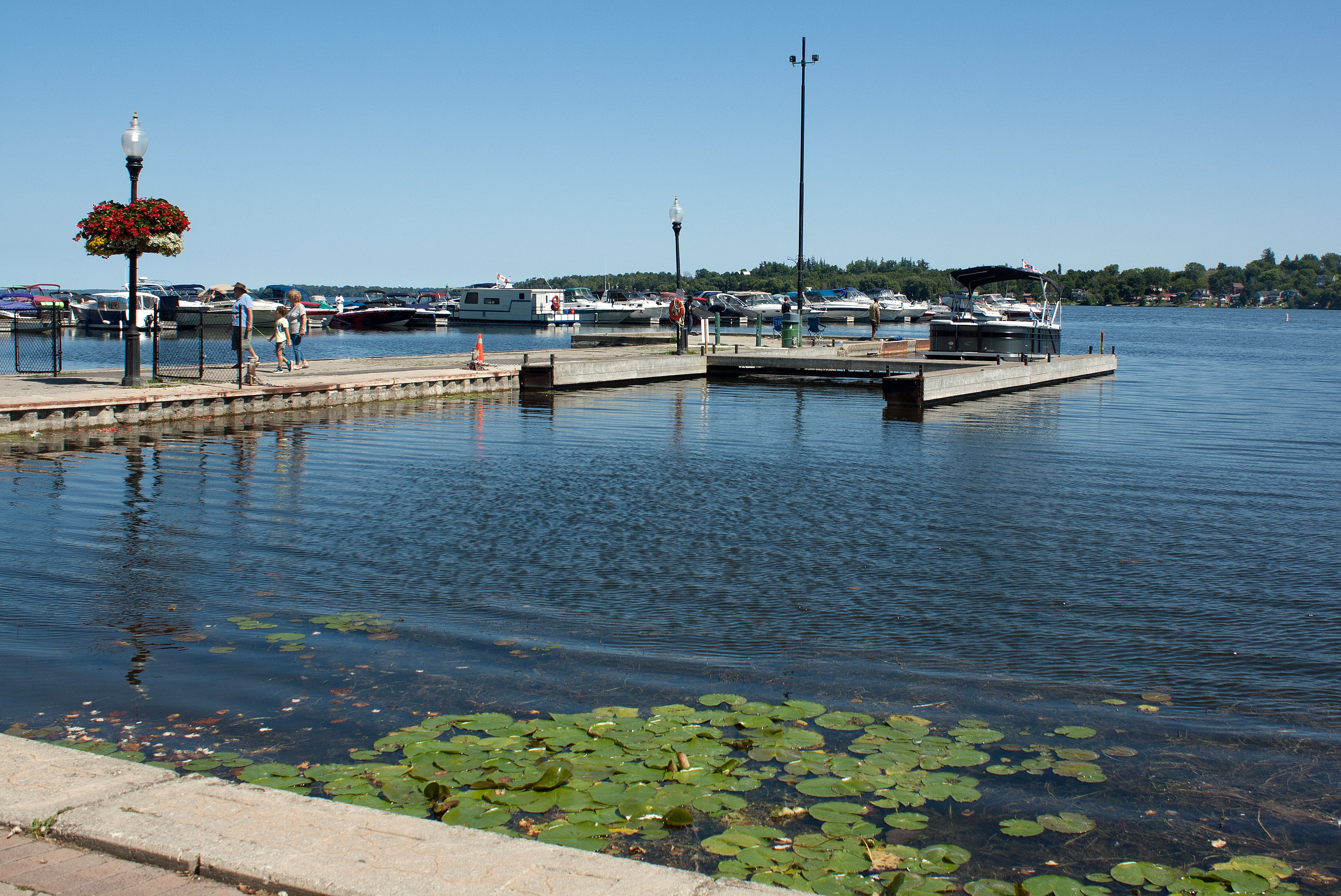
When we arrived, it was raining, which didn’t stop us from exploring, and soon we were wandering the shores of Lake Scugog at Palmer Park, where several harvesters crept along the lake by the marina, busy removing aquatic weeds and unloading their payload into large dump trucks.
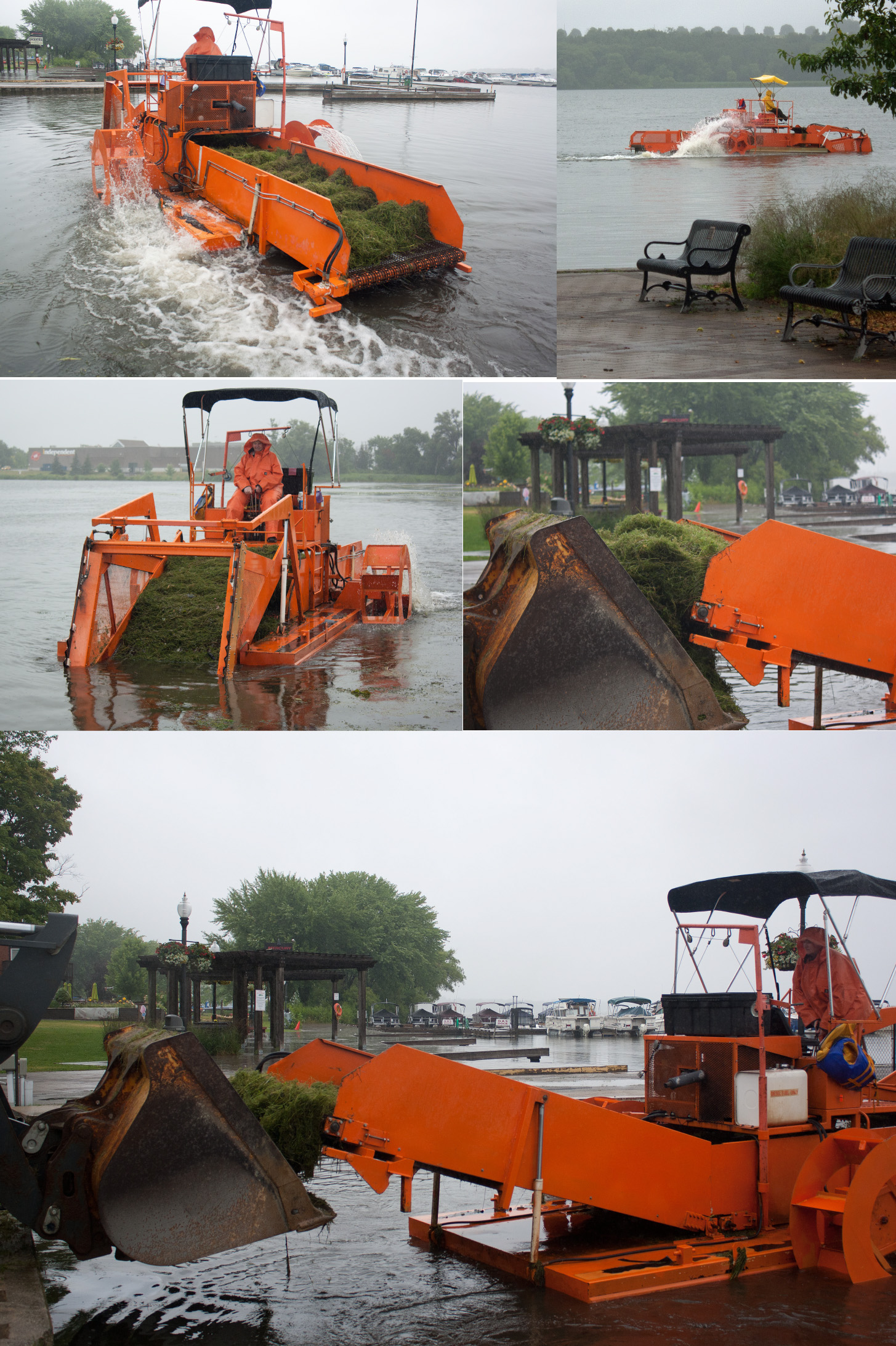
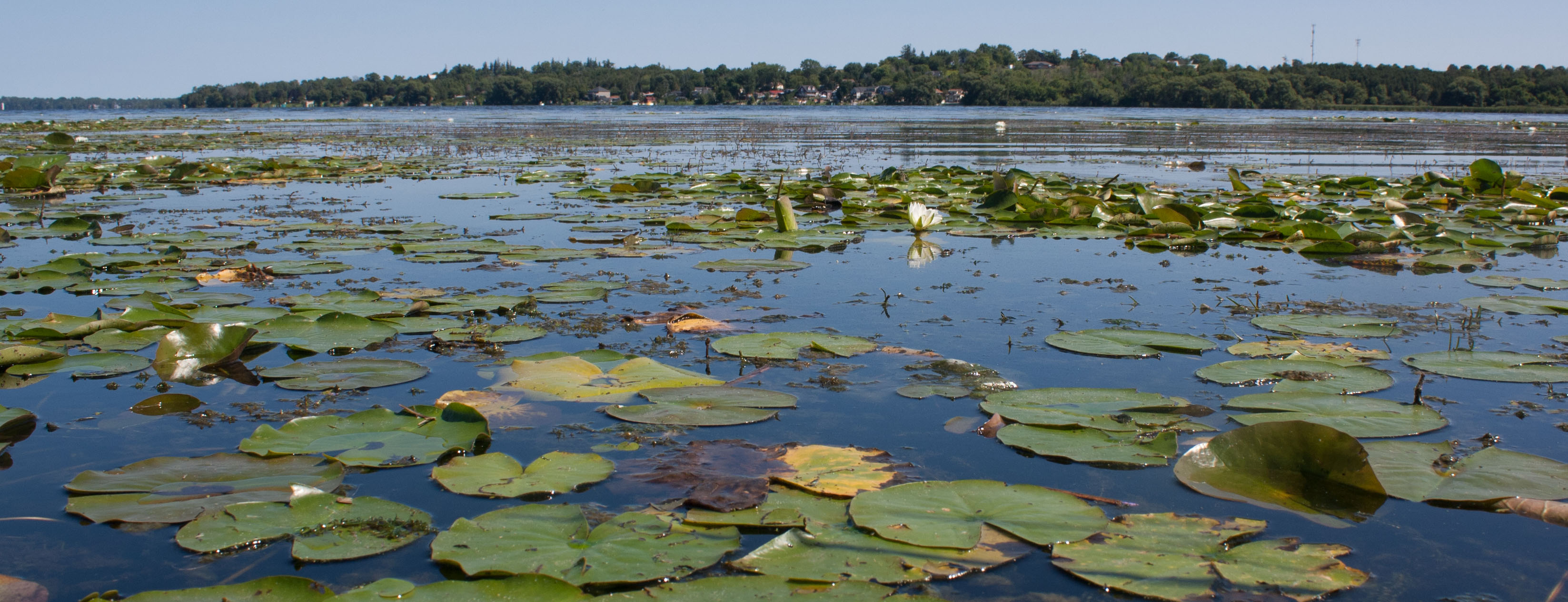
The story was that weeds have been choking the shorelines of the lake for decades. Apparently a hybridized form of milfoil has taken over the lake, despite the town’s introduction of thousands of milfoil-eating weevils. After rejecting the suggestion of dredging the lake, the Township purchased machinery to harvest and skim the weeds and they have been harvesting the small area by the marina since 2012. The upshot is that this remains a temporary (as in seasonal) solution because the weeds grow back; it’s like cutting the lawn. Most of the weeds in Lake Scugog can grow from just a fragment and no harvester can claim to efficiently remove all plant fragments as it harvests–or the roots or rhizomes, which just regenerate more shoots. The problem is far more complex and systemic. And it stems from the fact that Lake Scugog is highly eutrophic from an influx of nutrients (mainly phosphorus) that are in the water and accumulate in the sediments (periodically released through biotic and chemical interactions).
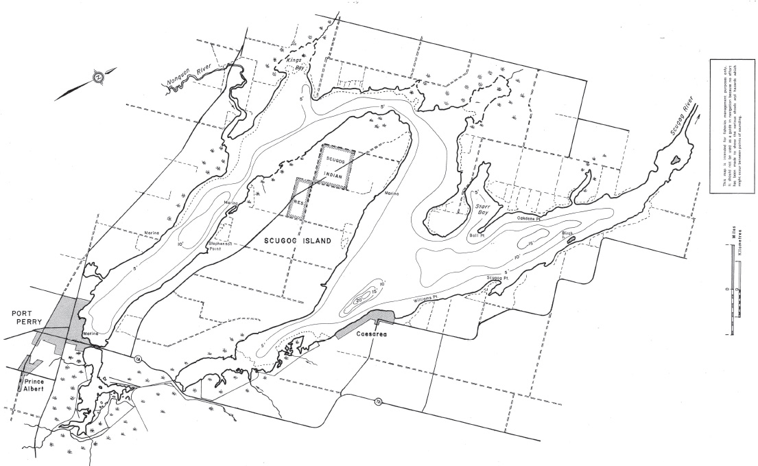
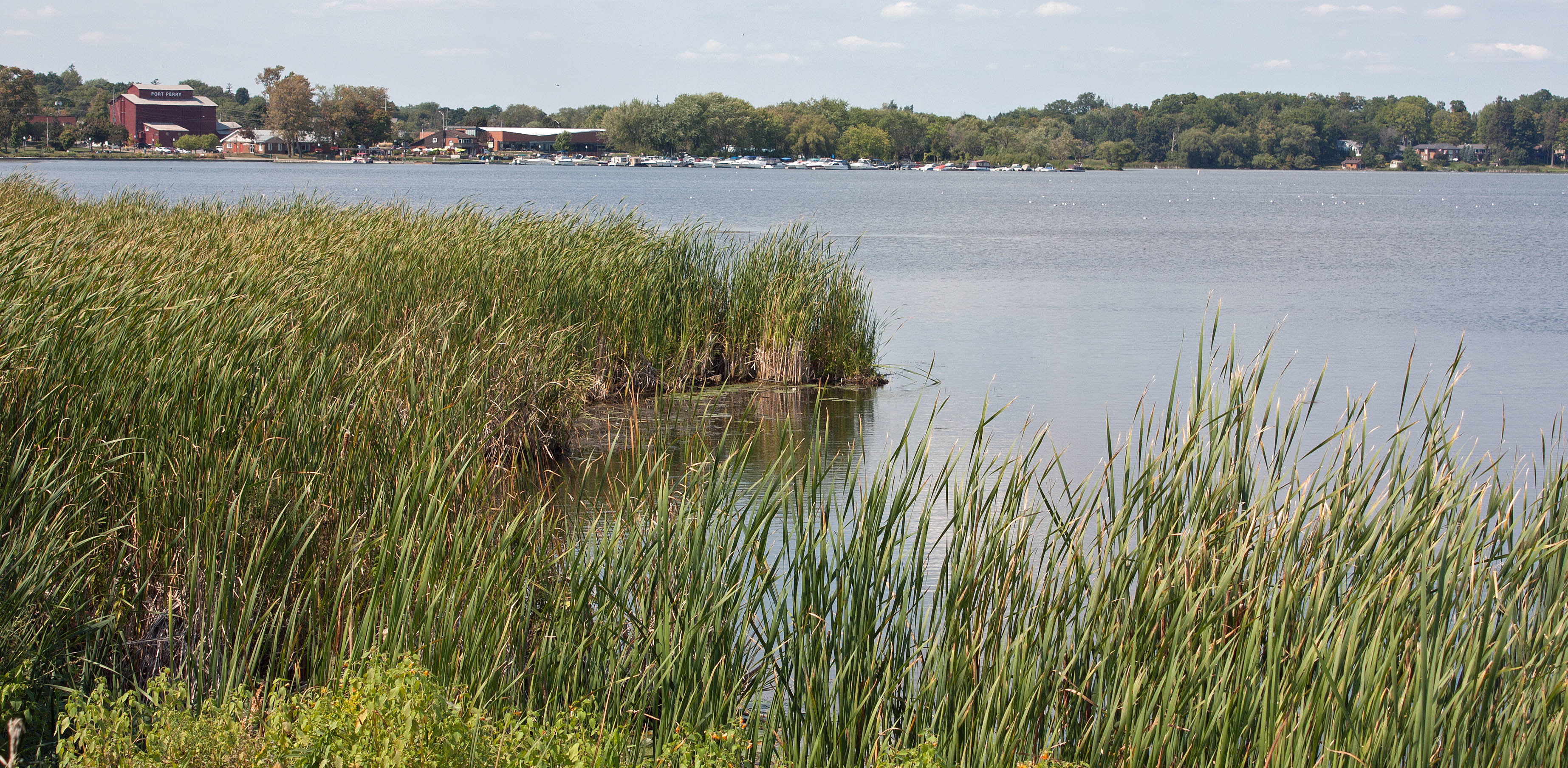
Like most of the Kawartha Lakes, Lake Scugog is a dammed lake that displays a dendritic convoluted shoreline. It is large and shallow, with two main basins or arms oriented more or less north-south and surrounded by extensive marshlands.
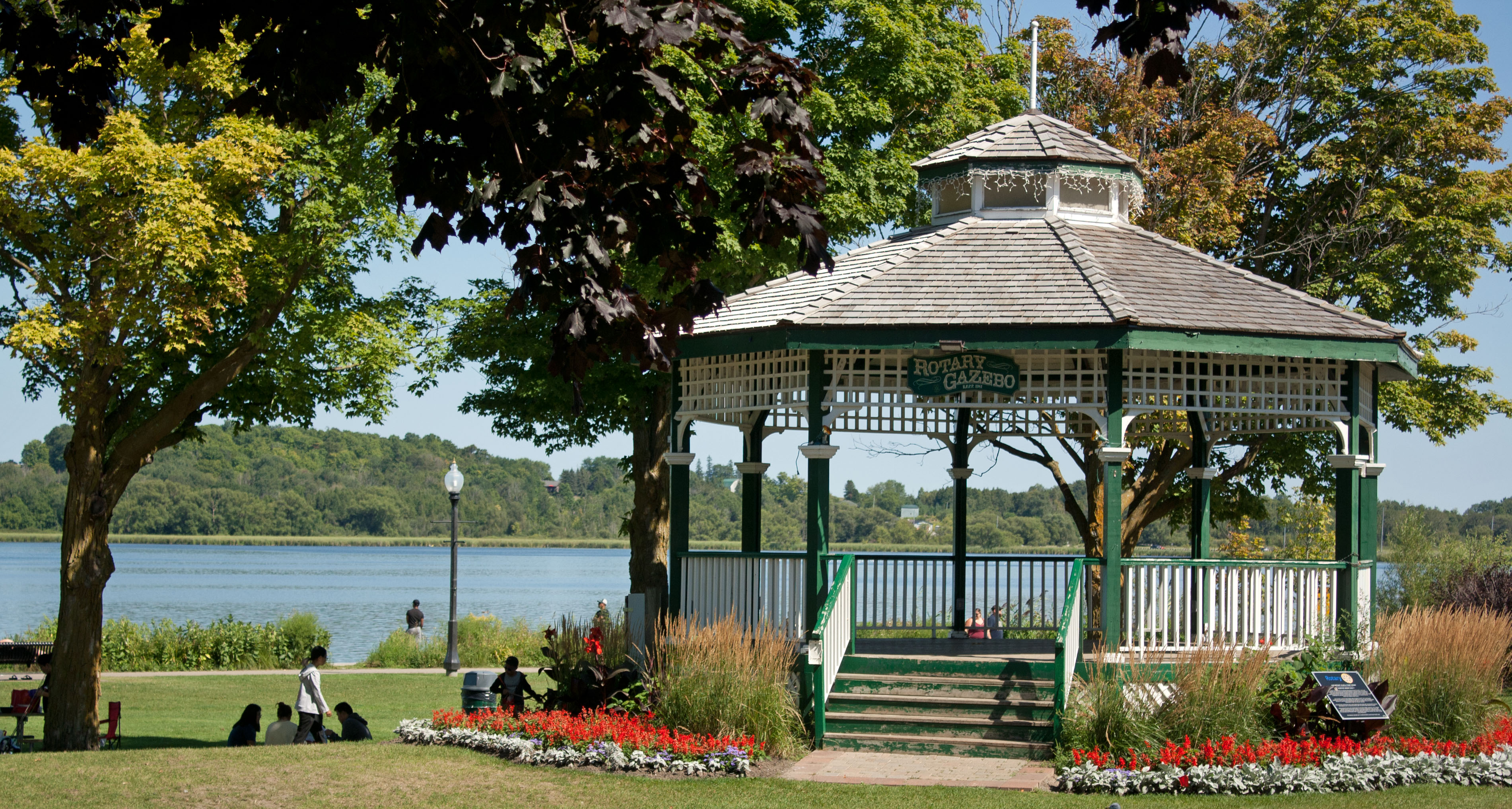
Lake Scugog is located about 65 km northwest of Peterborough, with the charming historic town of Port Perry sitting on the south-western shore of the western basin. I’ve visited Lake Scugog several times since that first time, often stopping in Port Perry to check out the lively market and craft festival, eat tasty fish and chips, and visit the quaint old bookstore on Perry Street.

Description of Lake Scugog & its Watershed
Lake Scugog is an artificially flooded lake via a dam in Lindsay. It is part of the Kawartha Lakes network formed on deep fertile soils that were deposited by glacial activity on top of limestone and shale bedrock. The primary inflow of Scugog Lake comes from Nonquon River, Blacksock Creek, Cawker’s Creek and the Cartwright wetlands. The lake is also fed by many springs along its shore and under its basin. Outflows from the lake flow north through the Scugog River to Sturgeon Lake and from there travels through the Trent-Severn Waterway to the other Kawartha lakes and finally out to Lake Ontario.

The lake is popular for fishing, mostly black crappie, walleye, largemouth and smallmouth bass, and perch. On one of my visits, I stopped to watch people fishing the lake along the park’s embankment of from the causeway or the park; one fisherlady was pulling out a fish every few minutes! She took a moment from her whirlwind fishing to show me one and I identified it as a Bluegill sunfish (Lepomus macrochirus).
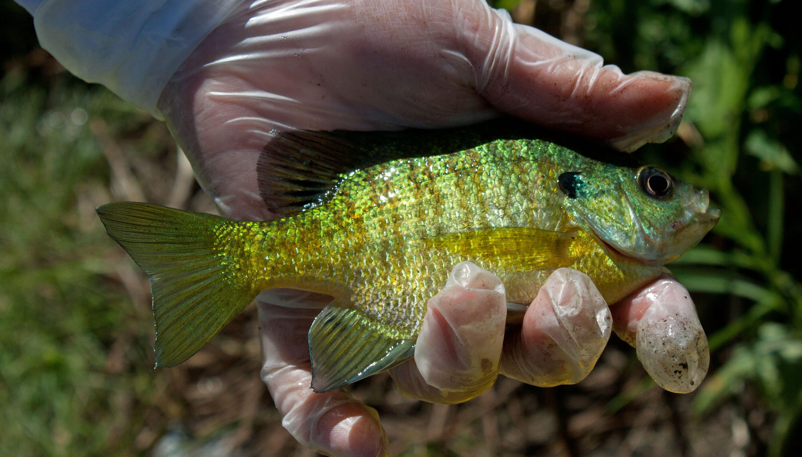
According to Extreme Philly Fishing, telltale identifiers include its oval shape, distinctly striped pattern (5-9 vertical bars) on the sides of the body, a yellowish breast and abdomen, a faded blue-shaded operculum (not as marked in a young fish) and totally black short opercular flap. The green on the fish’s back can be explained by the abundant vegetation; all markings vary according to the fish’s adaptation to its environment, where they eat rotifers and water fleas when young and aquatic insect larvae when adult. This popular panfish species can easily be found near docks, weeds and overhanging trees. People were successful using small jigs tipped with grubs, worms or crickets. I’m told the Bluegill make for great fish fry.
A 2020 survey reported by Kawartha Conservation reports that the lake has a surface area of 68 km2, an average depth of 1.4 m, maximum depth of 7.6 m, and shoreline length of 172 km. Its surrounding watershed is 141 km2. Wetland cover is reported to be 22.2 km2, providing 15.7% cover. The lake’s elevational level of 250 m above sea level is maintained by a dam in Lindsay, built in the 1830s, which raised the lake about two metres.


Scugog Marsh and Game Preserve
The area currently known as Scugog Marsh, south of the causeway, was predominantly swamp and marsh when Purdy’s Dam in Lindsay was constructed in 1830. Hunters, fishers, and trappers came from all over Ontario to the area. In the early 1800s the owner of the south marshland dredged several channels through the marsh to make the most remote areas of the marshland accessible for hunting ducks. By 1927 almost 20 miles of canals were dug. In the latter 1800s a causeway (bridge) was completed across the southern portion of the west basin, connecting the village of Port Perry with Scugog Island and in 1883 the Scugog Game Preserve Company (known as the “Sydicate”) bought the marshland for hunting and fishing. The marshland is currently privately owned by the Cartwright Land and Investment Company and still maintained by channels for hunting and fishing.

Given the excess input of nutrients phosphorus and nitrogen and its natural infilling, Lake Scugog shows obvious signs of advanced eutrophication. The shallow west arm—prone to urban runoff from Port Perry and surrounding cottage development—contains an extensive littoral zone (region where light reaches the bottom substrate), which promotes the growth of aquatic plants and algae. The lake is actively filling in from shoreline erosion, stormwater runoff, high concentrations of ‘dirt’ from the air and natural decomposition of hybrid Eurasian Watermilfoil and the invasive starry stonewort.

Brief Introduction to Eutrophication
All lakes, as they age, undergo a process called eutrophication: increased productivity with added nutrients over time. Levels of biologically useful nutrients such as phosphorus and nitrogen dissolved in the water of a lake determine its trophic (nutritional) status. When these limiting nutrients increase, higher plant growth is triggered and eutrophication takes place. Lakes are typically classified as oligotrophic, mesotrophic, or eutrophic based on their trophic (nutrient) status.
Oligotrophic lakes are typically young and cold lakes, low in productivity with high water clarity and well-oxygenated. With time, such a lake will gain nutrients, fill in, warm, and evolve into a mesotrophic lake. A mesotrophic lake will, in turn, evolve into a eutrophic lake, which will evolve into a bog, marsh or terrestrial environment. This is a natural process that occurs over time.
Mesotrophic Lakes have an intermediate level of productivity; these lakes have medium-level nutrients and are usually clear water with submerged aquatic plants.
Eutrophic Lakes have high levels of biological productivity. Plants are abundant due to available nutrients such as phosphorus and nitrogen. Fauna initially increase with increased plant and algal production, but eventually reduce when algal blooms overcrowd the lake and deplete the oxygen through decomposition.
Hypereutrophy occurs when human interference results in excessive nutrient loading and accelerated plant and algal growth. This increases the rate of eutrophication beyond its natural rate. Hypereutrophic lakes typically have visibility lower than a metre; they contain over 100 µg/L of phosphorus and more than 40 µg/L of total chlorophyll (algal) biomass in the water. The overgrowth of algae removes oxygen and suffocates all fauna, creating dead zones.
Cultural or accelerated eutrophication occurs when inputs from fertilizers, sewage, industrial waste water or other sources of nutrients are introduced by human sources; this leads to excessive plant and algal growth and potential oxygen depletion.

From an Ice Sheet to the Trent-Severn Waterway
The Wisconsin glaciation that covered virtually all of Ontario in up to a two-kilometer-high ice sheet formed the Oak Ridges Moraine about 12,000 years ago. According to Frederick M. Johnson the advancing and retreating ice sheet “plucked large quantities of this soft bedrock material and ground it into finer gravel, sand, silt and clay-sized particles. Large depressional areas were scoured out of the bedrock. These depressional areas became today’s lake basins such as Lake Simcoe and the Kawartha Lakes.”
Glacial ice blocked release of glacial meltwater, creating the large glacial Algonquin Lake to the north of the Oak Ridges Moraine. As the Laurentide Ice Sheet finally retreated, the Oak Ridges Moraine blocked previous drainage valleys of the giant glacial Lake Algonquin; but water found a way to drain. As the valleys overflowed, the currents carved new spillways, ultimately creating the Kawartha Lakes.
Although lakes on the more northern Precambrian Shield tend to be deep and rocky bottomed basins, the Kawartha Lakes—including Lake Scugog—are located on Paleozoic glacial deposits and have shallow basins of mostly flooded land.
As the glaciers retreated, forming lakes, thick sequences of lacustrine sediment were deposited in these lakes above the glacial units. These lake-associated deposits are observed extensively in the Lake Scugog basin. After these meltwaters retreated, erosion has been the dominant force with some sedimentation associated with river channels, storm water outlets and shoreline runoff, as well as the accumulations of organic material in poorly drained areas as deposits of peat and muck.
When the first European settlers and surveyors arrived in the early 1800s, the Mississauga First Nations were living on the shores of Scugog Island where, at the time two rivers branched off around the island and fed a small unnamed lake. The indigenous people harvested wild rice, picked cranberries and hunted deer and caribou. Pools of open water in deeper areas and channels marked the wetland expanse, which they called Scugog (submerged or flooded land). The southern region now called the “Cartwright Lands” was once a large tamarack swamp where deer and southern caribou used to forage.
The settlers cleared and drained the land for farming on the shores, impacting the First Nations peoples way of life. Then, in the 1830s, the Scugog River was inundated by Purdy dam for a mill at Lindsay, creating a reservoir and flooding much of the fertile farmland. The Purdy dam was in turn replaced by a lock system, which allowed better control of flooding but retained the lake in its present form.

The dam and lock became part of the Trent-Severn Waterway that linked several Kawartha Lakes including Balsam, Cameron, Sturgeon, Pigeon, Buckhorn and Chemong lakes. The waterway ultimately connects Lake Ontario at Trenton to the Georgia Bay part of Lake Huron at Port Severn. Construction of the waterway started in 1833 at Kawartha Lakes and took 87 years to complete. The flooding virtually eradicated the wild rice (mnoomin, meaning good grain) that flourished in the shallows of the original waterbodies, heavily impacting the the indigenous Anishinaabe peoples who drew their subsistence from the marshlands.
In the 1930s, Scugog became popular with tourists who enjoyed sport fishing and hiking the lakeshore. From the 1930s through to 1950s the area became inundated with summer cottage communities, who modified the shorelines (removing buffering wetlands and increasing erosion and sedimentation), put in septic tanks (which became faulty), used fertilizers on their lawns and released a myriad of contaminants and lake nutrients via runoff from their properties and stormwater outflows. Scugog’s dense maple, beech, pine and oak forests also gave way to agriculture which has resulted in a poor grade for watershed forest cover by Kawartha Conservation.
Increased development escalated lake aging and the eutrophication process; increased use of the lake also introduced Eurasian milfoil, which became abundant, increasing organic decomposition and impacting fish spawning grounds. Milfoil peaked then declined in the 1980s, possibly due to the milfoil weevil. However, by 2005, a hybrid native and Eurasian milfoil began to dominate the lake. The lake now supports the invasive zebra mussel, Curly-Leaf pondweed, and Starry stonewort. The starry stonewort is a Eurasisn/Japanese relative of the native charra, displacing other plants by forming a lower-story growth layer over much of the lake. Its proliferation creates an ideal environment for the zebra mussel, both depleting oxygen and promoting Microcystis blooms.

Rapidly Aging Lake Scugog
Fifty years ago, the Ontario Ministry of Environment designated Lake Scugog highly eutrophic, based on high concentrations of major ions, phosphorus (>30 µg/L) and chlorophyll a (>6 µg/L). Phytoplankton biomass ranged from 4.8 to 23.6 mm3/L and was dominated by the Cyanophyceae (blue-green algae) and the Bacillariophyceae (diatoms). Calanoids were rare and cladocerans abundant.
The 1976 Kawartha Lakes study by the Ministry of the Environment classified each Kawartha lake into one of three productivity groups based on the above criteria. Lake Scugog, along with Rice Lake, Sturgeon Lake, and the Bay of Quinte belonged in the third highly eutrophic group. The Ministry showed that lake productivity (and phosophorus content) was lower in the headwater lakes on the forested Shield (e.g. Balsam and Cameron lakes that have low concentrations of alkaline earth elements) and higher in the downstream lakes located in agricultural areas rich in calcareous sediments and inorganic nutrients.
Already in 1976, land drainage was recognized as the largest source of nutrient loading to all Kawartha Lakes. Lake Scugog measured 70.3 km3, its volume was 9.57 x 10⁷ metres, and mean depth of 1.4 metres. Slightly alkaline (pH of 8.4-8.6) and hard water (149-157). During their recent survey, Kawartha Conservation gave Lake Scugog a C grade for water quality based on elevated total phosphorus levels, which encourage nuisance algae and aquatic plant growth.
Scugog Lake Stewards lament the rapid aging of the lake:
“Lake Scugog is aging, — rapidly. We must all co-operate to prevent as much silt and sediment from entering the lake from eroding shorelines.”
The stewards describe several ways homeowners in the watershed and particularly along the lake shore can help to slow the advanced rate of aging “by protecting appropriately and by planting buffers of deep rooted native plants to absorb the nutrients.” See my section below that describes the Shoreline Owners Guide to Lakeland Living.
Lake Scugog Enhancement Project (LSEP)
In 2020 the LSEP (initiated by the Healthy Lake Scugog Steering Committee) aimed to improve water quality and recreational function of Port Perry Bay through the creation of a healthy wetland habitat, waterfront trail and installation of stormwater management infrastructure. Their ambition is to create a 1.4 hectare wetland habitat, 245 m walking trail and enhance stormwater treatment processes through the installation of oil and grit separators. Two large stormwater outfalls from urban Port Perry were targeted as the largest point sources of nutrient loads to the lake.
They also plan to increase the navigational depth of Port Perry Bay through dredging. The project is still under review with Parks Canada, Fisheries & Oceans and the Ontario Ministry of Environment, Conservation & Parks.
A Shoreline Owner’s Guide to Lakeland Living
Kawartha Conservation have put out an excellent guide for cottagers who live on or near the shore of the lake. Called “A Shoreline Owner’s Guide to Lakeland Living” this 28-page PDF document provides an excellent summary of a lake, its watershed and how it functions. They provide excellent advice on fish-friendly dock structure, low-impact lakeshore living, controlling invasives and nuisance growths, conservation tips and techniques to prevent and restore shoreline erosion and damage. They include best management practices for lake stewardship that are practical and can make a difference if enough residents adopt them.

References
Hvidsten, J. Peter. 2017. “Scugog Marshlands: The Scugog Game Preserve Company.”
Johnson, Frederick M. 1997. “The Landscape Ecology of the Lake Simcoe Basin,” Lake and Reservoir Management 13 (3): 226-239.
Kawartha Conservation. “Lake Scugog.”
Kawartha Conservation. 2019. “A Shoreline Owner’s Guide to Lakeland Living.” 28pp.
KLSA (Kawartha Lake Stewards Association). 2009. “The Root of the Matter…”: Lake Water Quality Report 2008. April. 73pp.
Ontario Ministry of the Environment. 1976. “The Kawartha Lakes Water Management Study—Water Quality Assessment (1972-1976).” November. 141pp.
Scugog Lakes Stewards Inc. 2020. “Lake Scugog General: 2020 Information about Lake Scugog.”
Scugog Lakes Stewards Inc. 2020. “The History of Lake Scugog.”
Todd, Brian J. and C.F. Michael Lewis. 1993. “A Reconnaissance Geophysical Survey of the Kawartha Lakes and Lake Simcoe, Ontario.” Geographie physique et Quaternaire 47 (3): 313-323.
Wehr, John D. and Robert G. Sheath. 2003. “Freshwater Habitats of Algae.” Chapter 2 In: “Freshwater Algae of North America.” Elsevier Science (USA)

Nina Munteanu is a Canadian ecologist / limnologist and novelist. She is co-editor of Europa SF and currently teaches writing courses at George Brown College and the University of Toronto. Visit www.ninamunteanu.ca for the latest on her books. Nina’s bilingual “La natura dell’acqua / The Way of Water” was published by Mincione Edizioni in Rome. Her non-fiction book “Water Is…” by Pixl Press (Vancouver) was selected by Margaret Atwood in the New York Times ‘Year in Reading’ and was chosen as the 2017 Summer Read by Water Canada. Her novel “A Diary in the Age of Water” was released by Inanna Publications (Toronto) in June 2020.
